
Long Distance Mountain Bike Trail, Stage 4 – From Aurel to Saint-Saturnin-les-Apt

Route
Difficulty
Duration
h
Distance
0.05km
Positive elevation
meters
Negative elevation
0 meters
Altitude
Min. meters
Max. meters
- circuit
- variante
- voie verte
- liaison
The tourist service at Aurel :
Here you find yourself on the Plateau de Sault, which is a landscape make up of vast open plains, shaped by fields of grains, grasses (small spelt) and lavender.
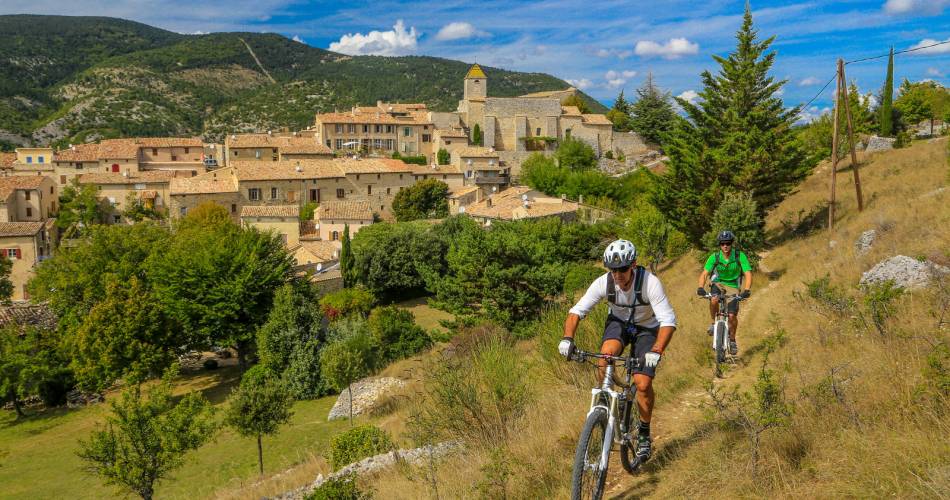
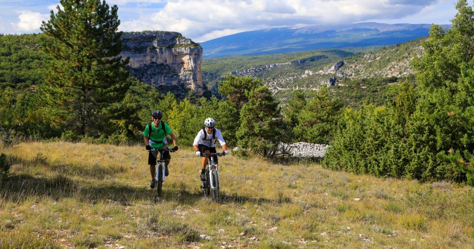
From Aurel, this fast-moving route, which offers little in the way of difficulty, will lead you to Sault and its racecourse, the highest in France (800 m), through woods and open spaces. It’s then an easy descent towards Monieux followed by one of the highlights of this long distance trail: the Nesque River Canyons. A superb path climbs up towards the Vaucluse mountains where you’ll enjoy an unforgettable view of the Gorges, one of the world’s most stunning canyons.
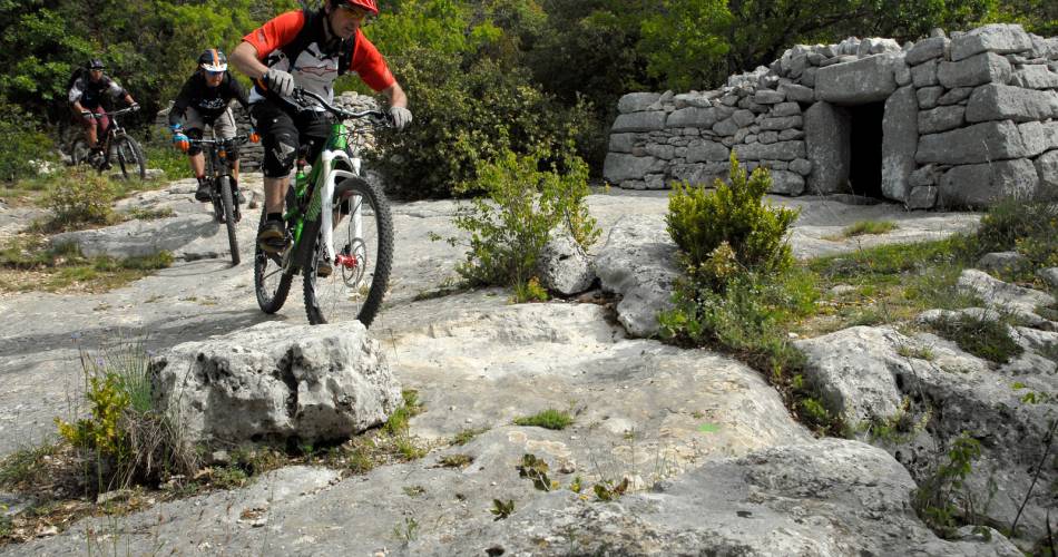
This long but extremely beautiful stretch boasts fabulous single-track trails through exceptional scenery. The trail through this remote and little frequented part of the Vaucluse mountains will eventually lead you to the Luberon Natural Regional Park. You’ll pass through a place known as Savouillon, after which you'll start to notice ancient stone water tanks (aiguiers), an extraordinary and typical feature of this region. The trail then descends towards Saint Saturnin-les-Apt, through the abandoned hamlet of Travignon, following a succession of paths that alternate between challenging and fast.
This long but extremely beautiful stretch boasts fabulous single-track trails through exceptional scenery. The trail through this remote and little frequented part of the Vaucluse mountains will eventually lead you to the Luberon Natural Regional Park. You’ll pass through a place known as Savouillon, after which you'll start to notice ancient stone water tanks (aiguiers), an extraordinary and typical feature of this region. The trail then descends towards Saint Saturnin-les-Apt, through the abandoned hamlet of Travignon, following a succession of paths that alternate between challenging and fast.
To be noted
 If you notice a problem on one of the Provence cycling routes report it with the Suricate app!: sentinelles.sportsdenature.fr
Access to the massifs
Respect the regulations preserving protected natural areas – find out about restrictions to accessing the massifs during fire risk periods, from 15 June to 15 September.
Before heading out, check the website
Respect the regulations preserving protected natural areas – find out about restrictions to accessing the massifs during fire risk periods, from 15 June to 15 September.
Before heading out, check the website
In short
Contact
Office de tourisme Intercommunal Ventoux Sud - BIT de SaultWebsite : http://www.provence-a-velo.fr
Facebook : https://www.facebook.com/OTI-Ventoux-Sud-1387460531503903/