
Sault, Aurel, Saint-Trinit, Saint-Christol
23 - The Plateau de Sault by bike
23
Route
Loop
Difficulty
Intermediary
Duration
3h
Distance
32.80km
Positive elevation
533 meters
Negative elevation
535 meters
Altitude
Min. 701 meters
Max. 1014 meters
- circuit
- variante
- voie verte
- liaison
Departure / Arrival
Sault / Sault
Parking
Sault
Elevation
Downloads
GPX track
The tourist service at Sault :
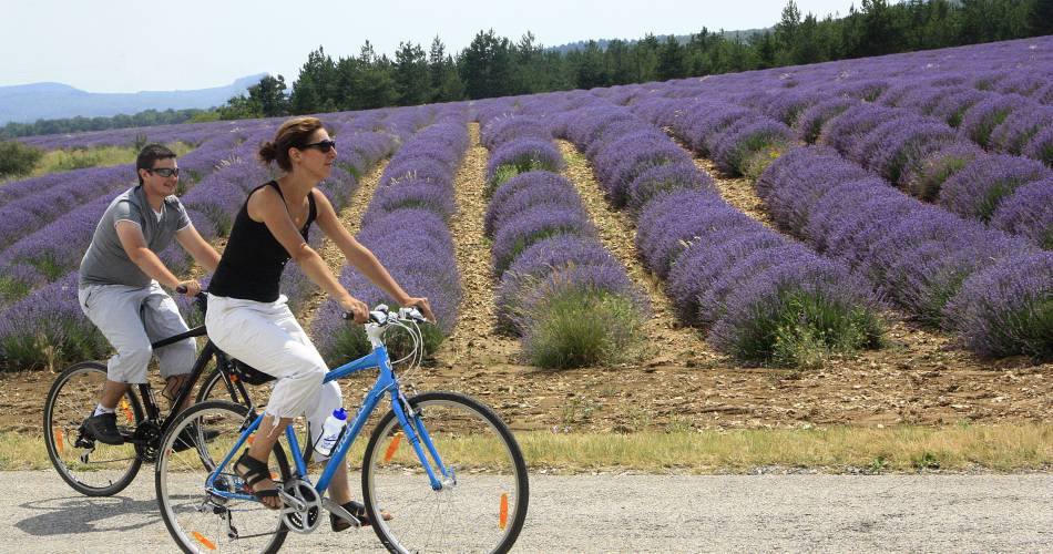
Through this itinerary you will discover a perched, isolated plateau, where you will find vast areas alternating in growing lavender and wheat - waving slowly according to the relief.
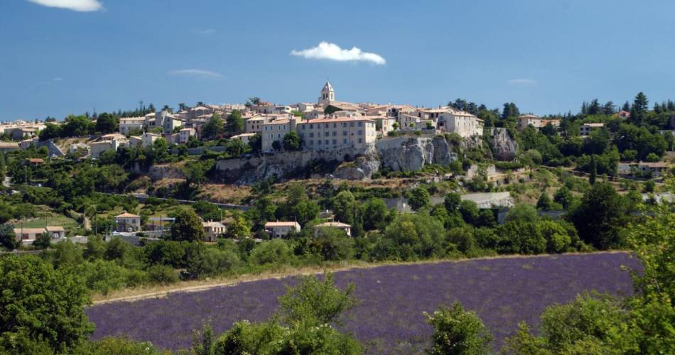
You will find water that springs up from the fountain of Vaucluse infiltrating this stony massif which is wedged between the Luberon and the Baronnies. This limestone plateau, dotted with caves and sinkholes, stretches from the Montagne de Lure to Mont Ventoux. Departing from Sault, this cycle itinerary is a pleasant circuit without huge technical difficulties. There is also the chance to see well-preserved, authentic villages where time sometimes seems to have stopped! Cycling in this area is well-integrated and this will be made clear by the cycle paths you will take according to the itinerary: from Aurel to Saint-Trinit, then Saint-Christol d'Albion which is a renowned place for speleology. Here, you will appreciate a protected and beautiful environment.
Itinerary created by CoVe and ADMV
www.destination-ventoux.com
Itinerary created by CoVe and ADMV
www.destination-ventoux.com
Accéder à l'itinéraire
recommended
parking(s)
Aires Car Park
road access
From Carpentras via the D942 to Villes-sur-Auzon then the D1
From Apt via the D943
From Vaison-la-Romaine via Entrechaux then the D40 to Savoillan then Aurel
From Apt via the D943
From Vaison-la-Romaine via Entrechaux then the D40 to Savoillan then Aurel
To be noted
 If you notice a problem on one of the Provence cycling routes report it with the Suricate app!: sentinelles.sportsdenature.fr
Access to the massifs
Respect the regulations preserving protected natural areas – find out about restrictions to accessing the massifs during fire risk periods, from 15 June to 15 September.
Before heading out, check the website
Respect the regulations preserving protected natural areas – find out about restrictions to accessing the massifs during fire risk periods, from 15 June to 15 September.
Before heading out, check the website
In short
- The vast Sault highlands, the splendid views over Mont Ventoux and Lure Mountain
- The fields of lavender and spelt (flowering in July and August)
- The villages of Sault, Aurel and Saint-Trinit: churches, narrow widing streets, fountains and more
Downloads
Contact
Communauté d'agglomération Ventoux-Comtat VenaissinE-Mail : oti@ventoux-sud.com
Website : https://www.ventouxprovence.fr