
15 - Toulourenc Valley

Route
Difficulty
Duration
420h
Distance
0.06km
Positive elevation
meters
Negative elevation
0 meters
Altitude
Min. meters
Max. meters
- circuit
- variante
- voie verte
- liaison
The tourist service at Entrechaux :
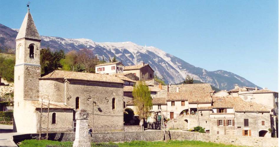
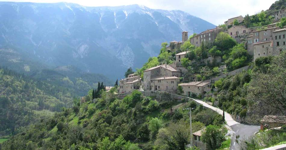
This cycle route will take you to Saint Léger, Brantes and Savoillans – three villages of the Toulourenc Valley.
Occasionally perched on hillsides, these villages offer an outstanding view of the steep northern face of the Mont Ventoux. This road is aimed at cyclists in good physical condition. It can be ridden in 2 days, enabling you to enjoy the restful villages.
Between Ventoux and Baronnies, this itinerary will lead you through Toulourenc Valley - 30 kilometres of deep, wild gorges. This athletic cycle route starts in Entrechaux, which is located where the Ouvèze and Toulourenc rivers converge. From here, you will set off to discover three villages of the valley. First, Saint-Léger-du-Ventoux, a small village positioned in a setting at the foot of the Ventoux overlooking a small fertile plain bordering Toulourenc. From here, you will then visit Brantes - a true eagle's nest inhabited by artists and craftspeople where it is serene and offers a vertiginous view of Mont Ventoux. Finally, you will reach Savoillans, lined with meadows and offering views of the crest of Ventoux up to its summit.
Created by Association Tourisme en Haut Vaucluse
www.hautvaucluse.com
To be noted
 If you notice a problem on one of the Provence cycling routes report it with the Suricate app!: sentinelles.sportsdenature.fr
Access to the massifs
Respect the regulations preserving protected natural areas – find out about restrictions to accessing the massifs during fire risk periods, from 15 June to 15 September.
Before heading out, check the website
Respect the regulations preserving protected natural areas – find out about restrictions to accessing the massifs during fire risk periods, from 15 June to 15 September.
Before heading out, check the website