
Long Distance Mountain Bike Trail, Stage 7 – From Saint-Saturnin-les-Apt to Vitrolles-en-Luberon

Route
Difficulty
Duration
275h
Distance
0.05km
Positive elevation
meters
Negative elevation
0 meters
Altitude
Min. meters
Max. meters
- circuit
- variante
- voie verte
- liaison
The tourist service at Saint-Saturnin-lès-Apt :
Although this section presents no real difficulties, there is one particular highlight that will take you through the Luberon’s renowned ochre massif. After a brief detour into the Alpes-Haute-Provence department, you’ll head for the Grand Luberon mountain range, along enjoyable and varied paths.
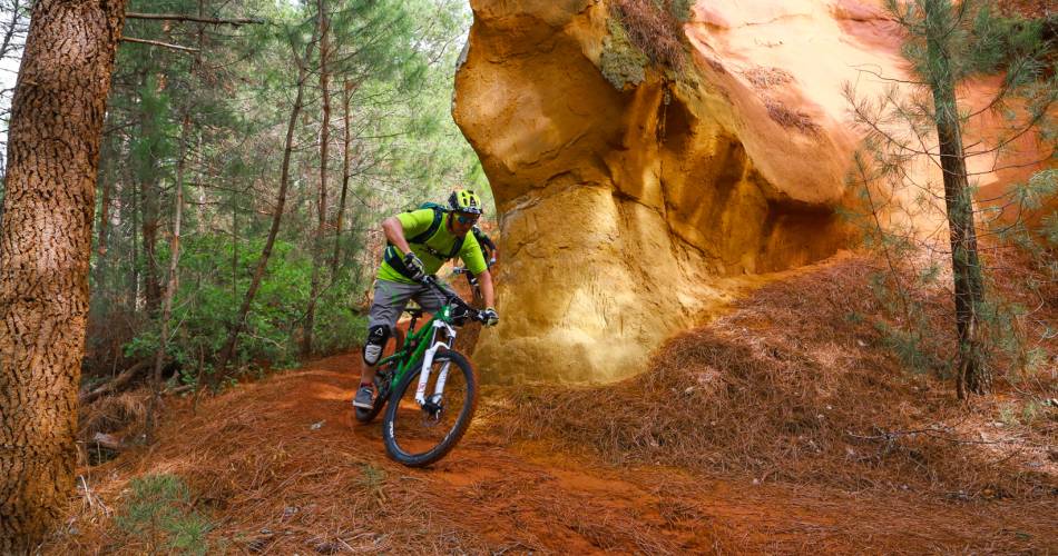
After a few kilometres of fast cycling through vineyards and cherry trees, along roads and paths, you’ll come to the ochre massif with its unusual landscapes and autumnal colours. The sandy and gritty single-tracks of the La Bruyère mountain range contrast with the hard, rocky landscapes of Provence. The ochre mountains then give way to stony trails leading to Rustrel. You’ll cycle along the Colorado Provençal, climbing a series of forest paths up to the Pierroux mountain ridge. This lovely single-track path, which boasts a wonderful panoramic view of the Lure mountain, will eventually lead you to the lovely village of Viens with its old city walls.
The scenic route down to the valley, that you’ll hit shortly after Viens, will quickly awaken the mountain biker in you! The trail leads to the banks of the Calavon river, then through an old abandoned railway tunnel, to Céreste. After this little foray into the Alpes-de-Haute-Provence department, you’ll cycle along the ridges of Montjustin and its village, renovated by Giono and friends. You’ll then climb the vast undulating hills of the Grand Luberon mountain range before racing down the western slopes to Vitrolles-en-Luberon, nestled in the southern foothills.
The scenic route down to the valley, that you’ll hit shortly after Viens, will quickly awaken the mountain biker in you! The trail leads to the banks of the Calavon river, then through an old abandoned railway tunnel, to Céreste. After this little foray into the Alpes-de-Haute-Provence department, you’ll cycle along the ridges of Montjustin and its village, renovated by Giono and friends. You’ll then climb the vast undulating hills of the Grand Luberon mountain range before racing down the western slopes to Vitrolles-en-Luberon, nestled in the southern foothills.
To be noted
 If you notice a problem on one of the Provence cycling routes report it with the Suricate app!: sentinelles.sportsdenature.fr
Access to the massifs
Respect the regulations preserving protected natural areas – find out about restrictions to accessing the massifs during fire risk periods, from 15 June to 15 September.
Before heading out, check the website
Respect the regulations preserving protected natural areas – find out about restrictions to accessing the massifs during fire risk periods, from 15 June to 15 September.
Before heading out, check the website
In short
Contact
Vélo Loisir ProvenceE-Mail : info@veloloisirprovence.com
Website : https://www.veloloisirprovence.com
Facebook : https://www.facebook.com/veloloisirprovence/