
Sault, Monieux, Lioux, Saint-Saturnin-Les-Apt
Stage 4: Sault/St-Saturnin-les-Apt Traversée de Vaucluse e-bike

Route
Crossing
Difficulty
Intermediary
Duration
5h
Distance
47.63km
Positive elevation
848 meters
Negative elevation
1 meters
Altitude
Min. 359 meters
Max. 1005 meters
- circuit
- variante
- voie verte
- liaison
Departure / Arrival
Sault / Saint-Saturnin-lès-Apt
Parking
Saint-Saturnin-lès-Apt
Elevation
GPX track
The tourist service at Sault :
Transitional route between the Massif du Ventoux and the Monts de Vaucluse, passing the Gorges de la Nesque. Magnificent lavender landscapes, limestone cliffs, borie villages, forest, and scrubland between Ventoux and Luberon that will make you forget the difficult passages of your journey.
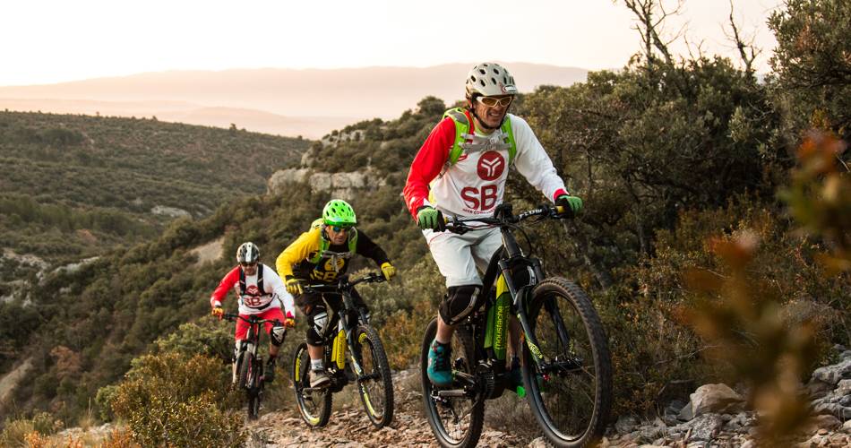
A more technical stage, but also an exceptional one! From Sault, you reach an easy descent that leads you to the gates of the Gorges de la Nesque. The route then climbs to the Monts de Vaucluse by a beautiful road, until reaching the stage’s accommodation in Saint-Hubert.
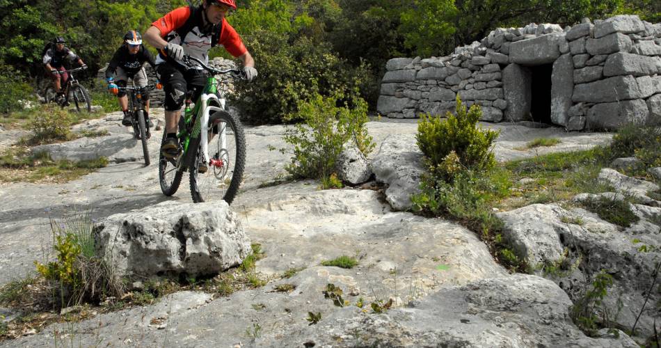
You then enter the territory of the Luberon Regional Natural Park, through a succession of paths and tracks between rocky valleys and the depths of anticlinal valleys. After this, the passage through the abandoned village of Travignon will remain etched in your memories. The heritage built in dry stone, including magnificent stone water basins, is remarkable here.
You then enter the territory of the Luberon Regional Natural Park, through a succession of paths and tracks between rocky valleys and the depths of anticlinal valleys. After this, the passage through the abandoned village of Travignon will remain etched in your memories. The heritage built in dry stone, including magnificent stone water basins, is remarkable here.
Accéder à l'itinéraire
public transport
Zou Bus Line 12Carpentras - Sault
recommended
parking(s)
Parking in the town centre
To be noted
The route only partially follows the markings for the Grande traversée de Vaucluse. Route adapted to e-bike. GPS required.
Before departure, make sure to consult the Prevention of fire risks in Vaucluse website, to respect the massif closures. (T. +33 (0)4.28.31.77.11)
This itinerary is best suited to autumn and spring
 If you notice a problem on one of the Provence cycling routes report it with the Suricate app!: sentinelles.sportsdenature.fr
Access to the massifs
Respect the regulations preserving protected natural areas – find out about restrictions to accessing the massifs during fire risk periods, from 15 June to 15 September.
Before heading out, check the website
Respect the regulations preserving protected natural areas – find out about restrictions to accessing the massifs during fire risk periods, from 15 June to 15 September.
Before heading out, check the website
In short
- Paths through the heart of the lavender fields
- Descent into the Gorges de la Nesque
- Successions of tracks and paths between limestone cliffs and valley bottoms,
- Discovery of the bories and stone water basins, and the dry stone village of Travignon.