
Malaucene, Beaumont-Du-Ventoux, Saint-Leger-Du-Ventoux
Cycling: Ascent of Mont-Ventoux from Malaucène
B
Route
Round trip
Difficulty
Very difficult
Duration
4h
Distance
18.37km
Positive elevation
1480 meters
Negative elevation
30 meters
Altitude
Min. 330 meters
Max. 1780 meters
- circuit
- variante
- voie verte
- liaison
Departure / Arrival
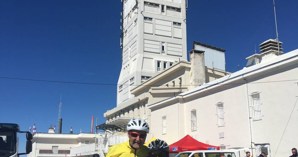
Malaucène / Sommet du Mont Ventoux
Parking
Sommet du Mont Ventoux
Elevation
Downloads
GPX track
The tourist service at Malaucène :
These 21 kilometres consist of an uneven ascent, 1535 metres of elevation, an average slope of 7.3% with short sections reaching nearly 13%. The circuit is best suited to well-practiced cyclists. Available from mid-May to mid-November.
This ascent can be broken down into 3 stages:
- From Malaucène to the Les Ramayettes Chalet in the forest
This section does not present any particular difficulty except for one kilometre with a 9-10% slope. The ascent changes in forest, staring smoothly after Malaucène, with a steeper passage from the 2nd kilometre, and easing again 3 kilometres higher.
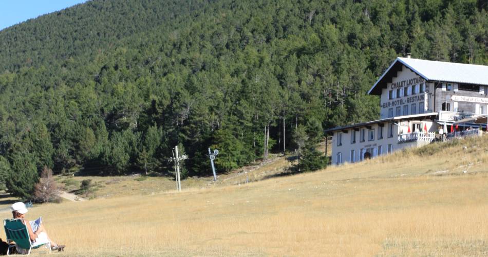
- From Chalet Les Ramayettes to Chalet Liotard
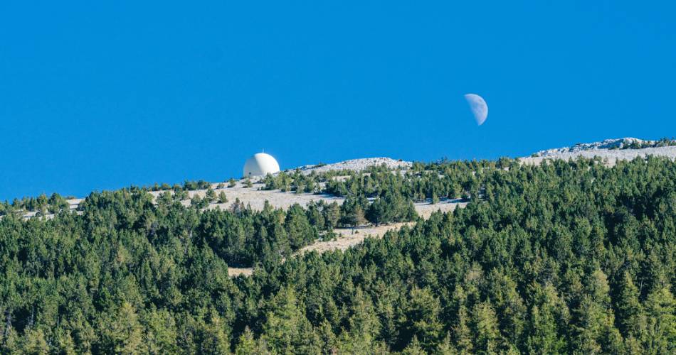
This second part is the most difficult of the three, with more than 3 arduous kilometres that follow each other without ever showing any respite. The slope increases suddenly at kilometre 10 and remains strong until kilometre 13.5, just before the arrival at the Chalet Liotard. The following section is easier and even has a few meters on the flat, letting you gather your strength before the climb to the summit. After leaving the forest the scenery transforms into the typical lunar landscape of Mont-Ventoux.
- From Chalet Liotard to the summit
The final path to the summit. The climb begins again suddenly after passing the chalet, reaching a 10% slope for nearly a whole kilometre, then easing for a moment before an irregular but relatively steep slope up to the summit.
On the northern face of the mountain, you can enjoy the superb panoramas of the Provençale Baronnies and the Alps.
Practical Information:
Scaling the Giant of Provence by bike requires preparation. Train before your departure, make sure you are in peak physical condition, equip yourself with a suitable road bike, and check the weather forecast.
Most accidents occur during the descent, so be careful and control your speed.
Water points on the route:
- Source du Groseau 1.7 km from the Tourist Information Office of Malaucène on the D974
- Mont Serein station
There are picnic areas and rubbish bins located throughout the route. Please dispose of your waste properly and do not litter.
- From Malaucène to the Les Ramayettes Chalet in the forest
This section does not present any particular difficulty except for one kilometre with a 9-10% slope. The ascent changes in forest, staring smoothly after Malaucène, with a steeper passage from the 2nd kilometre, and easing again 3 kilometres higher.
- From Chalet Les Ramayettes to Chalet Liotard
This second part is the most difficult of the three, with more than 3 arduous kilometres that follow each other without ever showing any respite. The slope increases suddenly at kilometre 10 and remains strong until kilometre 13.5, just before the arrival at the Chalet Liotard. The following section is easier and even has a few meters on the flat, letting you gather your strength before the climb to the summit. After leaving the forest the scenery transforms into the typical lunar landscape of Mont-Ventoux.
- From Chalet Liotard to the summit
The final path to the summit. The climb begins again suddenly after passing the chalet, reaching a 10% slope for nearly a whole kilometre, then easing for a moment before an irregular but relatively steep slope up to the summit.
On the northern face of the mountain, you can enjoy the superb panoramas of the Provençale Baronnies and the Alps.
Practical Information:
Scaling the Giant of Provence by bike requires preparation. Train before your departure, make sure you are in peak physical condition, equip yourself with a suitable road bike, and check the weather forecast.
Most accidents occur during the descent, so be careful and control your speed.
Water points on the route:
- Source du Groseau 1.7 km from the Tourist Information Office of Malaucène on the D974
- Mont Serein station
There are picnic areas and rubbish bins located throughout the route. Please dispose of your waste properly and do not litter.
Accéder à l'itinéraire
public transport
recommended
parking(s)
Post Office Car Park - Malaucène
To be noted
- Climbing the giant of Provence by bike needs proper preparation
- Before your departure, make sure you are in peak physical condition
- Use an adapted road bike and check the weather forecast before departure
- Carry warm clothes with you as there can be a 10 degree difference in temperature at the summit
- Most accidents occur during the descent so be careful, take breaks and control your speed.
Water points on the route:
- Source du Groseau 1.7 km from the Tourist Information Office of Malaucène on the D974
- Mont Serein station
There are picnic areas and rubbish bins located throughout the route, please dispose of your waste properly and do not litter.
 If you notice a problem on one of the Provence cycling routes report it with the Suricate app!: sentinelles.sportsdenature.fr
Access to the massifs
Respect the regulations preserving protected natural areas – find out about restrictions to accessing the massifs during fire risk periods, from 15 June to 15 September.
Before heading out, check the website
Respect the regulations preserving protected natural areas – find out about restrictions to accessing the massifs during fire risk periods, from 15 June to 15 September.
Before heading out, check the website
In short
From Malaucène to Ramayettes, the road crosses through woodland scenery, with a constant slope except at kilometre 9 (10%)From Ramayettes to Chalet Liotard (Mont Serein) the climb becomes more arduous, revealing beautiful views of the Alps and the Provençal Baronnies, with Vaucluse to the south.After the Chalet Liotard, the landscape takes on a lunar feel and the slope remains steep (reaching even 10% elevation) until the summit.