
Entrechaux, Mollans-Sur-Ouveze, Saint-Leger-Du-Ventoux, Brantes, Savoillan, Plaisians, Eygaliers, Buis-Les-Baronnies, La Penne-Sur-L'ouveze, Pierrelongue
15 - Toulourenc Valley
15
Route
Loop
Difficulty
Difficult
Duration
8h
Distance
52.73km
Positive elevation
871 meters
Negative elevation
873 meters
Altitude
Min. 238 meters
Max. 643 meters
- circuit
- variante
- voie verte
- liaison
Departure / Arrival
Entrechaux / Entrechaux
Parking
Entrechaux
Elevation
Downloads
GPX track
The tourist service at Entrechaux :
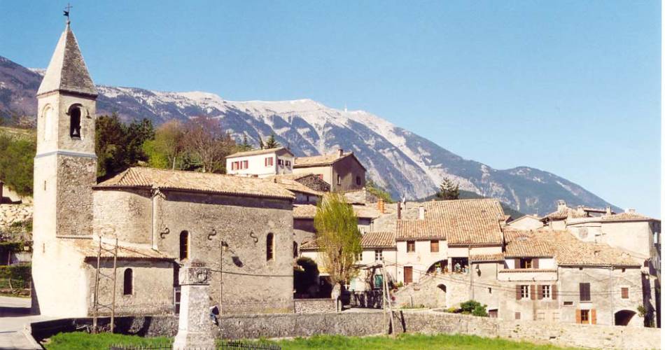
This cycle route will take you to Saint Léger, Brantes and Savoillans – three villages of the Toulourenc Valley.
Occasionally perched on hillsides, these villages offer an outstanding view of the steep northern face of the Mont Ventoux. This road is aimed at cyclists in good physical condition. It can be ridden in 2 days, enabling you to enjoy the restful villages.
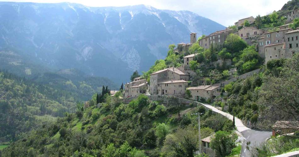
Between Ventoux and Baronnies, this itinerary will lead you through Toulourenc Valley - 30 kilometres of deep, wild gorges. This athletic cycle route starts in Entrechaux, which is located where the Ouvèze and Toulourenc rivers converge. From here, you will set off to discover three villages of the valley. First, Saint-Léger-du-Ventoux, a small village positioned in a setting at the foot of the Ventoux overlooking a small fertile plain bordering Toulourenc. From here, you will then visit Brantes - a true eagle's nest inhabited by artists and craftspeople where it is serene and offers a vertiginous view of Mont Ventoux. Finally, you will reach Savoillans, lined with meadows and offering views of the crest of Ventoux up to its summit.
Created by Association Tourisme en Haut Vaucluse
www.hautvaucluse.com
Accéder à l'itinéraire
recommended
parking(s)
Behind the Entrechaux church
road access
From Vaison-la-Romaine on the D938 then the D54From Malaucène on the D938 then the D13
To be noted
- Athletic route
- To take advantage of the views and charm of the villages on the route, we recommend using an electric bike.
- Avoid very hot days
 If you notice a problem on one of the Provence cycling routes report it with the Suricate app!: sentinelles.sportsdenature.fr
Access to the massifs
Respect the regulations preserving protected natural areas – find out about restrictions to accessing the massifs during fire risk periods, from 15 June to 15 September.
Before heading out, check the website
Respect the regulations preserving protected natural areas – find out about restrictions to accessing the massifs during fire risk periods, from 15 June to 15 September.
Before heading out, check the website
In short
A lovely athletic route that allows you to discover the northern face of Mont Ventoux.After Entrechaux comes the first pass at 328 m, the Pas du Voltigeur, before a second one, the «col de Veaux», at 386m. Past Saint-Léger-du-Ventoux, the road takes on a more alpine feel as far as Brantes and Savoillans.Breathtaking views of Ventoux from the hilltop village of Brantes. All of the villages on the route are worth stopping at.Downloads