
Vitrolles-En-Luberon, Cereste, Saint-Martin-De-Castillon, Peypin-D'aigues, La Motte-D'aigues, Cabrieres-D'aigues, Castellet, Auribeau, Sivergues, Saignon, Buoux, Apt, Bonnieux
Stage 6: Vitrolles-en-Luberon/Bonnieux Traversée de Vaucluse VTT e-bike

Route
Crossing
Difficulty
Intermediary
Duration
4h
Distance
45.62km
Positive elevation
1319 meters
Negative elevation
1 meters
Altitude
Min. 225 meters
Max. 1093 meters
The tourist service at Vitrolles-en-Lubéron :
This stage leads you through the heart of the Massif du Luberon up to its summit, the Mourre Nègre. You cross lavender plateaus and climb up to the dizzying heights of Buoux before reaching the hilltop village of Bonnieux.
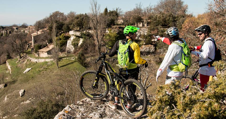
After a physically demanding start, you follow the paths along the wide ridges of the Grand Luberon and enjoy a panoramic view of the sea to the south and the Mont-Ventoux to the north.
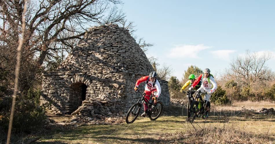
You next reach the summit of the Grand Luberon, the Mourre Nègre, which has a height of 1125 m. An easier descent then leads you into the refreshing valley of the Aiguebrun, where you pass the foot of the Fort de Buoux, then climb up to the plateau of Claparèdes, with its cortege of lavender fields and borie villages.
The route takes you gently, through a beautiful landscape of bocages and orchards, to the beautiful village of Bonnieux.
Accéder à l'itinéraire
public transport
Zou Bus Network Line 8 Cavaillon - Cucuron (via Lauris/Cadenet)
recommended
parking(s)
Parking Col de l'Aire des Mascas on D33, 4 km after Vitrolles en Luberon.
To be noted
Follow the GTV markings.
Before departure, make sure to consult the Prevention of fire risks in Vaucluse website, to respect the massif closures. (T. +33 (0)4.28.31.77.11)
This itinerary is best suited to autumn and spring
Before departure, make sure to consult the Prevention of fire risks in Vaucluse website, to respect the massif closures. (T. +33 (0)4.28.31.77.11)
This itinerary is best suited to autumn and spring
 If you notice a problem on one of the Provence cycling routes report it with the Suricate app!: sentinelles.sportsdenature.fr
Access to the massifs
Respect the regulations preserving protected natural areas – find out about restrictions to accessing the massifs during fire risk periods, from 15 June to 15 September.
Before heading out, check the website
Respect the regulations preserving protected natural areas – find out about restrictions to accessing the massifs during fire risk periods, from 15 June to 15 September.
Before heading out, check the website
In short
- Discovery of the Mourre-Negro
- Descent into the deep, cool valley of the Aiguebrun
- Ridge crossing on the cliffs of Buoux
- Discovery of the Claparèdes plateau, its lavender fields and its bories.
- Route between wooded countryside and orchards